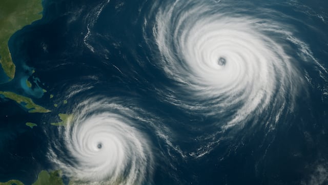
Sometimes Mother Nature isn’t satisfied with just a simple weather occurrence, so be sure to stay safe.

Tropical storm Humberto forecast: the rare Fujiwhara effect that could hit the Atlantic Ocean

Two tropical disturbances are currently swirling in the southwest Atlantic Ocean, and while neither has yet been named, both are likely to become tropical storms. The National Hurricane Center has designated them Invest 93L and Invest 94L. If they develop, they will be called Humberto and Imelda.
What makes this pair unusual is not just their timing but their proximity. Forecast models suggest the two could interact in a rare process known as the Fujiwhara effect, an event that could ultimately dictate whether either storm poses a threat to the United States. Keep an eye on the latest real-time updates.
How the Fujiwhara effect works
As I’ve said, the Fujiwhara effect happens when two cyclonic systems form close enough to influence each other’s movements. In the Northern Hemisphere, both rotate counterclockwise, and their circulations can draw them into an orbital “dance” around a shared midpoint.
If one storm is significantly stronger, it usually dominates, pulling the weaker one along or even absorbing it. If they are closer in size, they may spin around each other for days, causing sudden track changes. In very rare cases, two storms can even merge into a single, larger cyclone.
According to the U.S. National Weather Service, the effect typically becomes noticeable once storms move within about 900 miles of each other, intensifying if they close to within 400 miles.
Why the Atlantic rarely sees it
Fujiwhara interactions are much more common in the Pacific, where multiple cyclones often crowd the basin at once. In the Atlantic, storms tend to be more widely spaced, and large-scale steering patterns usually push them along set paths before they can meet.
That means Atlantic Fujiwhara events are rare, and when they do happen, they often end with one storm overpowering the other rather than a prolonged orbital dance.
Past Fujiwhara examples in the Atlantic
Still, the phenomenon has been recorded. Notable examples include:
- Hurricane Iris and Hurricane Humberto (1995): the two storms rotated around each other before Iris absorbed Humberto
- Tropical Storm Alpha and Hurricane Wilma (2005): Wilma drew Alpha into its circulation, a one-sided form of Fujiwhara absorption
- Tropical Storm Philippe and Tropical Storm Rina (2023): Philippe interacted with and eventually absorbed Rina, a modern textbook case.
What it means for Humberto and Imelda
For now, Invest 93L and 94L remain in the early stages of development. But if they strengthen and drift closer together, the Fujiwhara effect could shift their paths in ways forecasts cannot yet pin down.
Meteorologists say 94L – the disturbance with the greater chance of land impacts – may ultimately depend on how 93L evolves nearby. That makes this pairing one of the more complex and closely watched storm setups of the season.
Related stories
Get your game on! Whether you’re into NFL touchdowns, NBA buzzer-beaters, world-class soccer goals, or MLB home runs, our app has it all.
Dive into live coverage, expert insights, breaking news, exclusive videos, and more – plus, stay updated on the latest in current affairs and entertainment. Download now for all-access coverage, right at your fingertips – anytime, anywhere.
Complete your personal details to comment